

Trek Highlights
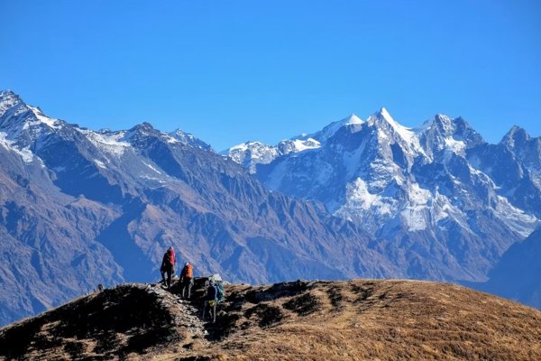
• Walk on a rare 360° mountain ridge (unique in India)
• Experience a thrilling knife-edge ridge walk
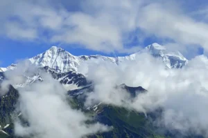
• Panoramic views of Swargarohini, Bandarpoonch & Kala Nag
• Trek through lush forests & alpine meadows
• Stunning campsites like Sikolta & Bhoj Gadi
• Located inside Govind Pashu Vihar National Park
• Perfect mix of adventure + scenic beauty
• Less crowded & hidden gem trek
• Ideal for beginners with good fitness
Trek Details
| Detail | Information |
|---|---|
| Duration | 6 Days |
| Maximum Altitude | 12,150 Ft |
| Trek Distance | 29 KM |
| Difficulty | Easy to Moderate |
| Region | Uttarakhand, India |
| Starting Point | Dehradun |
| Base Camp | Sankri |
Detailed Itinerary
Day 1 – Dehradun → Sankri
Altitude: 6,400 ft
Drive Distance: 200 km
Duration: 9–10 hours
Drive to Sankri, base for many Himalayan treks.
Day 2 – Sankri → Sikolta
Altitude: 9,400 ft
Trek Distance: 7 km
Duration: 5–6 hours
Ascend through dense forests to campsite.
Day 3 – Sikolta → Bhoj Gadi
Altitude: 11,100 ft
Trek Distance: 4–5 km
Reach scenic meadow campsite with mountain views.
Day 4 – Bhoj Gadi → Phulara Ridge → Pushtara
Altitude: 12,150 ft
Trek Distance: 8.5 km
Duration: 6–7 hours
Experience the iconic Phulara Ridge walk with 360° views.
Day 5 – Pushtara → Taluka → Sankri
Trek Distance: 8 km
Drive Distance: 12 km
Descend through forests and drive back.
Day 6 – Sankri → Dehradun
Drive Distance: 200 km
Return journey and trek completion.